Showing posts with label smoke. Show all posts

Saturday, August 15, 2015

Sleepless in Owyhee


Saturday August 15 2015

It seemed a bit surreal that we were making an emergency evacuation plan. We didn't need it yet, but, we made plans. Sure, over the years, I've cringed during lightning storms, and watched the summer wildfires, and felt stabs of empathy and horror for friends who have dealt with fire and evacuations. Just yesterday near Baker City, Oregon, endurance friends Naomi and Lee had to evacuate, but with fire on their doorstep, the wind changed at the last minute and spared their house. But now we're actually dealing with it ourselves.

When the Soda fire started over in Jordan Valley over on the other side Owyhee mountains on Monday, we noticed. We took more notice when the 'pyrocumulus' clouds started becoming visible  from down in our canyon when an edge of the fire was (rather suddenly) 20 miles away.

driving into Murphy

When on Thursday this fire had become the biggest fire in the country, and our endurance friend Karen was on notice for possible evacuation near Murphy, we decided we'd better have a plan to get all the crick critters out of here. It's pretty much a 5-mile one-way-out road for horse trailers. Murphy is 12 miles away as the Raven flies. There's a LOT of cheat grass on the Owyhee Front between here and there, which can burn in a flash, if the fire reached down onto the flats.

the road to Silver City is closed

We've got 13 horses here to move. Neighbors, who happen to be gone at the moment, have 9. Linda, further down has 1 horse and a whole 'nother assortment of 4-legged things. We've got a place to move the animals, some 12 miles or so down the highway to a pretty safe place. We've got all the horse trailers up and down the crick hitched up and ready to roll. It would take roughly an hour round trip, catching, loading, driving, unloading, driving back. It would take 2 loads with all four trailers = roughly 2 hours. (And we wouldn't shave it that closely!)

behind Murphy

When we got the news that Karen was on standby to evacuate yesterday evening, Regina and I drove to Murphy. The fire and smoke was boggling - I mean, I've ridden out there; I know some of that country. And now it's burned!? And when you saw how long the line of fire and smoke was, and understood how huge this fire is, like 40 miles long and 30 miles wide - and you realized Murphy is just one small corner of this fire - it's almost incomprehensible. Fortunately, so far, no loss of human life, but it's sad to think of all the ranchers' cattle, and the wild horses in the fire's path.

A large contingency of firefighters were re-grouping at Murphy at sunset. Despite the 'cold front' predicted to blow in with strong north winds (in our direction) overnight, Murphy was not under evacuation orders, and fire crews seemed to think they could halt southern expansion.

looking back at Murphy from the other side

Around 11 PM, the wind kicked up here at home, the acrid smoke blew in, the temperatures took a dive, and the wind kept up howling much of the night. Not much sleep was had. (Nor the night before, as a lightning storm moved through to the east of us).


By morning, we were socked in with smoke. My lungs hurt from breathing it all night.
This morning's sunrise over Bates Creek

Inciweb had not been updated, so we drove back out to Murphy this morning. They're socked in with smoke too, but it appeared the fire line had indeed held, and we saw bulldozers and a plane out there working, and fire trucks headed out various roads toward the mountains where the heavy smoke was. So even with a strong north wind today, and the fire up to 277,000 acres (and only 15% contained), we're still in a safe spot, even with the closest moving fire edge 12-14 miles away as the Raven flies.

night view from west of Murphy… blurry from hand-held telephoto

It is somewhat maddening in this day and age of technology not to get updates (as of 2 PM, Inciweb said it was current, but the fire map had not been updated, and the news updates are old), but even more so for those nearest the fire and on the edge of evacuating.

We've been offered help in the form of trailers, help moving and driving, and places to board horses by so many people, and for that we are grateful. Now - we just sit and wait.


smoky day up the crick. eyes and lungs burn just standing or sitting around! good day not to ride

Here's a slideshow of pix from last night:


or a link to the album.

Wednesday, August 12, 2015

Owyhee's On Fire

Wednesday August 12 2015

First a flash flood; now a fire.

Those aren't pretty fluffy clouds that turn into dragons or pigs or wizards.

Those are smoke clouds, bubbling up from the Soda fire raging in Owyhee County, the closest edge of the fire being 20-25 miles away from us as the Raven flies.


Lightning is expected to have ignited the fire on Monday along the Oregon/Owyhee county Idaho border, and in the last 24 hours, with gnarly winds buffeting the fire across drought-dry, cheatgrass-rich desert and grazing lands, the fire has quickly exploded in all directions, covering over 200,000 acres now (it was 100,000 yesterday!). At one point it grew 1.5 miles in 8 minutes.

As anxious Owyhee-uns (and Oregoni-uns) are keeping an eye on its progress, social media is buzzing and chattering with offers of horse trailers, and places to evacuate horses if necessary.

We are directly east of the lower edge of the fire (in fact slightly to the south), and with hot temperatures and wind forecast for the next couple of days (which is what helped the fire explode rapidly), I'm watching that forecast every hour. For the fire to spread here though, wind would have to come from the north at some point; but so far, winds are predicted to shift between southeast and southwest, up to 15 mph. Lucky for us, but not so much for those to the north, east and west of the fire.


Sunday, September 16, 2012

Smoke Alarm


Sunday September 16 2012

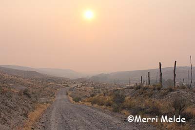
What you see above is not the magical golden light of autumn. What you see below is not flat land in the Owyhee desert. There are 4000 feet worth of mountains straight ahead.

Smoke moved in this morning, quickly, thickly, obscuring the Owyhee mountains, covering the area like a heavy blanket. Eye-burning, lung-singeing, cough-generating, panic-inducing smoke. 

A flurry of phone calls: neighbors, 911; check the fire websites, ride the ATV up onto the flats to see if there's anything to see. Nothing to see but more smoke; nothing new to report.

The closest fire is the Trinity Ridge fire in the Boise National forest, about 50 miles as the Raven flies from here, 146,000 acres. It started on August 3rd (human caused), is 64% contained, estimated containment date October 1st.

Incredible how smoke can travel so far in such a dense pack, up and down mountains, through canyons  and draws, with wind twisting it up and down and sideways, and it still arrives all of a sudden in a mob on your doorstep 50 miles away, thick enough to scare you into thinking it's just over the next hill.

Not a good day to go on a 20-mile ride, or to hike trails to start putting out ribbons for the Owyhee Canyonlands. 

(This is home, 1/2 mile away)

Sunday, July 1, 2012

Where There's Smoke...


Sunday July 1 2012

I'm in bed, trying to yell. Someone's outside the door, and I'm not scared, but I'm trying to yell, to let them know I'm here. But I can't yell. It comes out muffled. I try again several times, doesn't work. I try yelling again and lifting my hands. The hand movement wakes me up - and I smell smoke.

Holy Crap! That's wildfire smoke I smell and it's heavy, and it's blowing outside - maybe 10 mph with 15 mph gusts.

It's 3:21 AM.

Being fire-spooked lately by the Colorado Springs wildfire (my brother was evacuated for 5 days; their house was spared), I'm already half in panic mode as I grab a flashlight and shoes and leap outside wide awake.

I immediately see a blazing light! - but that's the near-full moon on the western horizon through the trees. But why is the moon orange?

I step further away from the creek trees to get a better view of the sky. Even with the moonlight I can make out smoke in the air but I don't see an obvious looming wall of fire. But we live in a drainage at the junction of 2 creeks - my view is limited by hills on 3 sides of us. I can't see up on the flats. I see a glow in the sky to the northwest, where the wind is blowing from… that's probably Nampa/Boise. But are the city lights that far west? Or is it something else making that glow?

I head for the ridge, for the ten-minute climb up onto the flats. I can see the smoke is thick through the moonlight. I can feel it in my lungs as I breathe it. It's burning my eyes.

Only two things besides Wildfire! - How close?? on that uphill march pop into my head. One is, Where are the Wire Cutters? I know where one pair hangs in the horse-less barn, and I have another sturdy pair right by my door, but bolt cutters would be great. We don't have bolt cutters. Do you know how hard it is to cut through a tight barbed wire fence with just the wire cutters? It can be done, but if you're talking about cutting fence in a hurry, you're talking 4 strands of doubled wire - and likely more than one cut in a fence. (Of course if you're in a panic, adrenaline will probably help you chomp right through those wires.)


The other thing that I think of is, we should have grease pencils to mark our horses with our phone number.

The hike to the ridge in the strong wind is slightly panicky and eye-watering and lung-burning - and un-revealing. At the highest point on the flats, I still see nothing but the glow on the horizon (it must still be Nampa/Boise), but no flames licking the sky, no glow dancing on the horizon, no clue of any kind. The smoke is still heavy, and even after the moon has sunk behind the Pickett Creek Saddle in the Owyhee mountains, outlining the pillow of clouds in an orange glow, I can clearly see the layers of desert hills, given depth and definition by the smoke.

Where is this coming from??

I climb back down to the house, grab my binoculars, GPS, and phone, and get in my car, and drive to the highway - 5 miles down the dirt road (away from the wind and smoke), and the mile toward the highway (I stop on the road, get out and still smell heavy smoke), and drive 5 miles on the highway back into the wind. The highway rolls and dips, and I drive to one of the highest points, where I stop the car, turn off the lights and get out (on this southwest Idaho highway, you can often stop in the middle of the road, even during the daytime).

I still see nothing, though the smoke smell is still strong in the brisk wind. The source of this abundant heavy smoke is still a mystery, but since I can see no obvious path of fire moving toward our ranch I can tell we are safe at least till morning. When I get home at 4:30 AM, the smoke and the smell has lessened there, and nothing obvious shows up on Inciweb.org.

When I wake in the morning, the horses are hanging out as usual, nothing is amiss, and life on the Crick goes on. There's only a slight, occasional whiff of smoke smell in the air, but still no clue where that heavy wave came from last night. I know smoke can travel a long way, but it smelled so thick and strong

I'm going to make sure I know where all the wire cutters are located, and next time I'm in town, I'm getting bolt cutters and grease pencils.

It all made me think of and be grateful for the firefighters, who breathe the smoke and blink through stinging eyes as they put their lives in harm's way to battle a beast of Mother Nature, because all I want to do is flee.

And I'm sure grateful the smoke alarm in my head works.


P.S.: the smoke likely was the Jump Creek fire - about 40 miles away (see Knotty Dogs' comment).
It was started by fireworks.
How stupid can people be?