Showing posts with label fire. Show all posts

Monday, July 24, 2017

We Had *The Talk*


Monday July 24 2017

The Fire Talk. Comes with summer and thunderstorms and from a spring and summer that produced highly flammable and prevalent cheat grass and weeds after an unprecedented winter of moisture.

The Fire Talk came up a couple of weeks ago as we helplessly watched our B.C. Canadian friends evacuated, barred from going in or out, or trapped on their place surrounded by fires (so far, they are OK, and back home, but the fires are still on-going.)

What would we do here?

We're 5 miles down a dirt road - surrounded by cheat grass-laden BLM land. Between 4 residences, we have 20+ 4 legged equids (and a passel of goats and dogs and such). (And, if you count the next neighbors, add 15 or so more horses, though they have some big dry lots.) The main way out is this bumpy 1-lane dirt road. An alternate way out is a much longer bumpier 1-lane dirt road that leads up to the Owyhee Mountains, and eventually off in different directions.

We have a big water tank on a trailer… but what comes out of that is not much more than a regular hose's worth of pressure. We've mowed weeds, but they're still growing and they leave dried stumps behind. We have plenty of green grass and trees around the house, and some dry paddocks. Plenty of water spigots around if the electricity is on. A small generator or 2. But what is all of this if a fire is roaring, and a 40 mph wind is blowing, and the fire creates its own weather and wind?

We have several horse trailers, either 2 or 4 horse trailers… but 1 trip with each would not accommodate all the horses.

It depends on where the fire comes from and how close it is. 

And when. Daytime? Middle of the night? More than once, I've been startled awake by a thick, acrid smell of smoke. I've jumped out of bed and run outside looking, hiking, climbing hills… trying to see from whence a fire might be coming (it's always been from fires some 40 and more miles away, but you wouldn't know it by the heavy smoke smell).

And it depends on where the fire comes from, and how close it is - that will determine what we do. If we have time to haul horses - great. If we don't, then what. Do we just have to jump in our cars and flee to save ourselves? I've got a bag packed by the door. I hope I never have to grab it, but I know where my keys are hanging. Do we have time to round the horses up and chase them out? Where? Up our canyon? Out the back gate east? Down the main dirt road northeast? Up the dirt road west? The barbed wire gates are open and ready if we need to chase horses up or down the road.

We have the memory of the Soda Fire from 2 years ago - 300,000 acres that came within 15 miles - still burning in our minds. Now we have thunderstorms in the forecast this week, and a Fire Weather Watch today from noon to midnight. 

Another reason I hate summer: I HATE FIRE SEASON.

We can just wait and watch and hope and pray it's not the year for this area to burn.


Saturday, August 15, 2015

Sleepless in Owyhee


Saturday August 15 2015

It seemed a bit surreal that we were making an emergency evacuation plan. We didn't need it yet, but, we made plans. Sure, over the years, I've cringed during lightning storms, and watched the summer wildfires, and felt stabs of empathy and horror for friends who have dealt with fire and evacuations. Just yesterday near Baker City, Oregon, endurance friends Naomi and Lee had to evacuate, but with fire on their doorstep, the wind changed at the last minute and spared their house. But now we're actually dealing with it ourselves.

When the Soda fire started over in Jordan Valley over on the other side Owyhee mountains on Monday, we noticed. We took more notice when the 'pyrocumulus' clouds started becoming visible  from down in our canyon when an edge of the fire was (rather suddenly) 20 miles away.

driving into Murphy

When on Thursday this fire had become the biggest fire in the country, and our endurance friend Karen was on notice for possible evacuation near Murphy, we decided we'd better have a plan to get all the crick critters out of here. It's pretty much a 5-mile one-way-out road for horse trailers. Murphy is 12 miles away as the Raven flies. There's a LOT of cheat grass on the Owyhee Front between here and there, which can burn in a flash, if the fire reached down onto the flats.

the road to Silver City is closed

We've got 13 horses here to move. Neighbors, who happen to be gone at the moment, have 9. Linda, further down has 1 horse and a whole 'nother assortment of 4-legged things. We've got a place to move the animals, some 12 miles or so down the highway to a pretty safe place. We've got all the horse trailers up and down the crick hitched up and ready to roll. It would take roughly an hour round trip, catching, loading, driving, unloading, driving back. It would take 2 loads with all four trailers = roughly 2 hours. (And we wouldn't shave it that closely!)

behind Murphy

When we got the news that Karen was on standby to evacuate yesterday evening, Regina and I drove to Murphy. The fire and smoke was boggling - I mean, I've ridden out there; I know some of that country. And now it's burned!? And when you saw how long the line of fire and smoke was, and understood how huge this fire is, like 40 miles long and 30 miles wide - and you realized Murphy is just one small corner of this fire - it's almost incomprehensible. Fortunately, so far, no loss of human life, but it's sad to think of all the ranchers' cattle, and the wild horses in the fire's path.

A large contingency of firefighters were re-grouping at Murphy at sunset. Despite the 'cold front' predicted to blow in with strong north winds (in our direction) overnight, Murphy was not under evacuation orders, and fire crews seemed to think they could halt southern expansion.

looking back at Murphy from the other side

Around 11 PM, the wind kicked up here at home, the acrid smoke blew in, the temperatures took a dive, and the wind kept up howling much of the night. Not much sleep was had. (Nor the night before, as a lightning storm moved through to the east of us).


By morning, we were socked in with smoke. My lungs hurt from breathing it all night.

This morning's sunrise over Bates Creek

Inciweb had not been updated, so we drove back out to Murphy this morning. They're socked in with smoke too, but it appeared the fire line had indeed held, and we saw bulldozers and a plane out there working, and fire trucks headed out various roads toward the mountains where the heavy smoke was. So even with a strong north wind today, and the fire up to 277,000 acres (and only 15% contained), we're still in a safe spot, even with the closest moving fire edge 12-14 miles away as the Raven flies.

night view from west of Murphy… blurry from hand-held telephoto

It is somewhat maddening in this day and age of technology not to get updates (as of 2 PM, Inciweb said it was current, but the fire map had not been updated, and the news updates are old), but even more so for those nearest the fire and on the edge of evacuating.

We've been offered help in the form of trailers, help moving and driving, and places to board horses by so many people, and for that we are grateful. Now - we just sit and wait.


smoky day up the crick. eyes and lungs burn just standing or sitting around! good day not to ride

Here's a slideshow of pix from last night:


or a link to the album.

Wednesday, August 12, 2015

Owyhee's On Fire

Wednesday August 12 2015

First a flash flood; now a fire.

Those aren't pretty fluffy clouds that turn into dragons or pigs or wizards.

Those are smoke clouds, bubbling up from the Soda fire raging in Owyhee County, the closest edge of the fire being 20-25 miles away from us as the Raven flies.


Lightning is expected to have ignited the fire on Monday along the Oregon/Owyhee county Idaho border, and in the last 24 hours, with gnarly winds buffeting the fire across drought-dry, cheatgrass-rich desert and grazing lands, the fire has quickly exploded in all directions, covering over 200,000 acres now (it was 100,000 yesterday!). At one point it grew 1.5 miles in 8 minutes.

As anxious Owyhee-uns (and Oregoni-uns) are keeping an eye on its progress, social media is buzzing and chattering with offers of horse trailers, and places to evacuate horses if necessary.

We are directly east of the lower edge of the fire (in fact slightly to the south), and with hot temperatures and wind forecast for the next couple of days (which is what helped the fire explode rapidly), I'm watching that forecast every hour. For the fire to spread here though, wind would have to come from the north at some point; but so far, winds are predicted to shift between southeast and southwest, up to 15 mph. Lucky for us, but not so much for those to the north, east and west of the fire.


Monday, July 29, 2013

Fire on the Mountain


Monday July 29 2013

There are soooo many reasons I do not like summer, but if I list them all this will be a Whine-Fest blog entry. So I will only list one.

WILDFIRE.


I've been here in Owyhee for 6 years now, and up until the last 2 years, fire never crossed my mind.

Then there was that summer day 2 years ago where lightning started a fire 4.5 miles away up on the sagebrush flats, while we were away at City of Rocks. Fortunately the gusting wind was blowing the other way, and the BLM fire crews were on it in a flash.

Last year, there was the night heavy smoke woke me up.

Now, anytime a blue thunderstorm cloud appears, instead of rejoicing (well - as long as I'm indoors watching, and not caught out in it!) in the few degrees of coolness it lends for a spell, an undercurrent of fear keeps that delight at bay. Wildfires are getting worse by the year out West, as it gets drier and drier.

Yesterday a cloud came over, giving blessed relief from the heat. But then the cloud turned blue and thunderstormy, rumbling loudly enough that even *I* heard the thunder. It dropped a little rain down here, and did its lightning and thundering in the Owyhee mountains.

I did not even SEE this smoke until this afternoon, but it was surely lightning that started it. It's 7 miles away, straight up our canyon. The BLM already knew about it, and was letting it burn… then later in the day they sent helicopters with buckets to it.

The only good thing about being in a drought is that it's been so dry, there's hardly any fuel to burn - stunted sagebrush and rabbitbrush, no cheat grass at all.

By evening it looked like most of the fire was out, though it's so hazy it's difficult to tell, even with binoculars. There's still a spiral of smoke (still, fortunately, no wind to speak of), and I might be seeing a layer of fire retardant on the hill.

I'm sure hoping that's the closest and biggest fire we'll have here this year.


Sunday, September 16, 2012

Smoke Alarm


Sunday September 16 2012

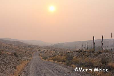
What you see above is not the magical golden light of autumn. What you see below is not flat land in the Owyhee desert. There are 4000 feet worth of mountains straight ahead.

Smoke moved in this morning, quickly, thickly, obscuring the Owyhee mountains, covering the area like a heavy blanket. Eye-burning, lung-singeing, cough-generating, panic-inducing smoke. 

A flurry of phone calls: neighbors, 911; check the fire websites, ride the ATV up onto the flats to see if there's anything to see. Nothing to see but more smoke; nothing new to report.

The closest fire is the Trinity Ridge fire in the Boise National forest, about 50 miles as the Raven flies from here, 146,000 acres. It started on August 3rd (human caused), is 64% contained, estimated containment date October 1st.

Incredible how smoke can travel so far in such a dense pack, up and down mountains, through canyons  and draws, with wind twisting it up and down and sideways, and it still arrives all of a sudden in a mob on your doorstep 50 miles away, thick enough to scare you into thinking it's just over the next hill.

Not a good day to go on a 20-mile ride, or to hike trails to start putting out ribbons for the Owyhee Canyonlands. 

(This is home, 1/2 mile away)

Saturday, August 11, 2012

Just Say No to Summer


Saturday August 11 2012

Summer: For some, fun in the sun, barefoot in dirt, splashing in water, bright rays shooting down, tanning bodies, lightening hair.

I'm wired backwards. I can't stand being hot. I hate that sun beating down on me.

My only relief comes with the very rare - especially in this desert, particularly with this drought - cloudy day. I love the leaden clouds blotting out the sky. Spitting rain sends me into a tizzy, my head turned up to the heavens. Even without the rain, my spirits perk up because the clouds bring a break in the heat that I so desperately detest.

But this summer, I pay the price with the clouds. The clouds bring thunderstorms. The thunderstorms bring lightning. Lightning brings fire.

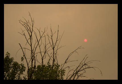
I got my clouds yesterday, but the thunderstorms came too. When the thunderheads moved on, a different cloud remained, leaving the sky dark and turning the sun blood red: smoke. 

A friend in Murphy emailed "Where is the fire? The channel 7 news at 5 said 300 acres south of Oreana, but the smoke makes me think it is bigger than that.  Lots of planes heading down that way.  Are you guys ok?  Can you see the fire?"

11 miles from here as the Raven flies, lightning struck the top of Toy Mountain in the Owyhees. Thank goodness the fire guys were on it quickly. Thank goodness there was no wind yesterday. Planes flew overhead all afternoon, back and forth between Boise and the mountain.

We saw the mountain still smoking while out riding this morning: the 'Pony Fire'. 500 acres, but it's 80% contained. Fire on the mountain and a forecast of smoke tomorrow. The skies remain hazy, smoky; the sunset colorful. But the cooling clouds are gone. It's hot again. 

I don't dare hope for any more clouds to cool me off. I just dream of winter, and wait.

Tuesday, July 10, 2012

City of Rocks: Sabotaged Ribbons and Smoke!


Tuesday July 10 2012

I got dropped off at 7500 feet to hike down the trail to the Bread Loaves to confirm the trail markings for tomorrow's Day 1 (and all 4 days) of the City of Rocks Endurance ride… and some of the ribbons had been either eaten by cows, or pulled by people. 

I know cows eat ribbons (but I don't know why they eat ribbons), but why would people pull ribbons? Steve Bradley our photographer, while out scouting good picture-taking spots, discovered where some missing ribbons were: some campers had helped themselves to some and had pinned the bright colors to their camp clothes line. I mean - really? 

Now tomorrow, even though I hung out new ribbons, I have to re-hike the trail ahead of the riders to make sure the new ribbons haven't disappeared again. I would have brought my hiking shoes if I'd'a known I'd been doing so much hiking! But that's OK, because the views are spectacular, no matter how many times you see them.

Meanwhile, the fire report: We heard that the fire back home at Oreana is under control, with crews just watching hot spots. That's a great relief.

Meanwhile, here at City of Rocks, with today's afternoon thunderstorm, we suddenly saw smoke rising above the forested Albion Mountains - not far from where we started our hike this morning, where the riders will be riding. It overshadowed Ridecamp.

We called the Forest Service to ask about it, and they said they were just sending out crews to check it out. Steve rode out to a lookout in the mountains, and got a great shot of the smoke plume:

He saw a chopper and two planes flying around. Then when another thunderstorm dumped a bunch of rain in that area, a valley-full of white smoke blew our way - the kind of smoke you get from a doused fire.

A couple of crises averted today - just routine modus operandi for an endurance ride!

Monday, July 9, 2012

City of Rocks Trail Marking And... Fire at Home...


Monday July 9 2012

We're here at City of Rocks marking trail (on the ATV today!), enduring thunderstorms and a lot of delicious rain... and this afternoon I just got an email from a neighbor back home:

"Fire in Oreana - 
This afternoon there was a lightning strike near Oreana that started a fire.  It started on the south side of Hwy 78 and moved across to the north side near Rye Patch Road.  It appears all structures are safe.  The wind is blowing it away from Bates Creek. Rocky was there stopping traffic from proceeding southwest.  Hopefully the road will re-open by tomorrow and I will be able to give you an update when I get there."

Just 4 miles from our ranch.

4 miles from Stormy.

We've been somewhat frantically calling home to see what the status is.

Fortunately it sounds like the wind is blowing it away from us, and there are fire crews, dozers, helicopters on it.

Criminy.

Thursday, July 5, 2012

The City of Rocks Journey Begins


Wednesday July 4 2012

Yesterday Regina and Kat and I hauled a 4-horse stock trailer full of stuff (John said "Pack It Like You Mean It", and we did!) to City of Rocks basecamp in preparation for our 4-day City of Rocks Pioneer Trail Endurance Ride on July 11-14. 

It was a 4-hour drive there (got stuck trying to get through Albion, where the streets were clogged with 4th of July Parade stuff). Once there, we unhitched the trailer, and put up fencing for the 8 or so horses we'll be using to mark and unmark trail, and to ride during the ride. It took us 4 hours to get back, not counting the birthday party/dinner at Virginia's that we had the luck to time just right.

Today, Steph and I are headed back to City of Rocks for good with 4 horses, and everything else including two kitchen sinks, for a couple of weeks. Judy's already on her way with 3 horses, and Regina's following on Saturday with 3 more horses.

Meanwhile, here in Owyhee a Fire Weather Watch is in effect for Friday and Saturday:

...RED FLAG WARNING IN EFFECT FROM NOON TO 9 PM MDT FRIDAY FOR
LIGHTNING FOR WESTERN TWIN FALLS BLM AND OWYHEE MOUNTAINS... 

THE NATIONAL WEATHER SERVICE IN BOISE HAS ISSUED A RED FLAG
WARNING FOR LIGHTNING...WHICH IS IN EFFECT FROM NOON TO 9 PM MDT
FRIDAY.  

* THUNDERSTORMS...ABUNDANT LIGHTNING POSSIBLE WITH SCATTERED
  THUNDERSTORMS.

* OUTFLOW WINDS...GUSTY OUTFLOW WINDS IN EXCESS OF 40 MPH.

PRECAUTIONARY/PREPAREDNESS ACTIONS...

A RED FLAG WARNING MEANS THAT CRITICAL FIRE WEATHER CONDITIONS
ARE EITHER OCCURRING NOW...OR WILL SHORTLY. A COMBINATION OF
STRONG WINDS...LOW RELATIVE HUMIDITY...AND WARM TEMPERATURES WILL
CREATE EXPLOSIVE FIRE GROWTH POTENTIAL.

So, in addition to losing my marbles getting ready for the new City of Rocks ride, I'll be worrying the rest of my head off about FIRE back home.

Oh boy!

Sunday, July 1, 2012

Where There's Smoke...


Sunday July 1 2012

I'm in bed, trying to yell. Someone's outside the door, and I'm not scared, but I'm trying to yell, to let them know I'm here. But I can't yell. It comes out muffled. I try again several times, doesn't work. I try yelling again and lifting my hands. The hand movement wakes me up - and I smell smoke.

Holy Crap! That's wildfire smoke I smell and it's heavy, and it's blowing outside - maybe 10 mph with 15 mph gusts.

It's 3:21 AM.

Being fire-spooked lately by the Colorado Springs wildfire (my brother was evacuated for 5 days; their house was spared), I'm already half in panic mode as I grab a flashlight and shoes and leap outside wide awake.

I immediately see a blazing light! - but that's the near-full moon on the western horizon through the trees. But why is the moon orange?

I step further away from the creek trees to get a better view of the sky. Even with the moonlight I can make out smoke in the air but I don't see an obvious looming wall of fire. But we live in a drainage at the junction of 2 creeks - my view is limited by hills on 3 sides of us. I can't see up on the flats. I see a glow in the sky to the northwest, where the wind is blowing from… that's probably Nampa/Boise. But are the city lights that far west? Or is it something else making that glow?

I head for the ridge, for the ten-minute climb up onto the flats. I can see the smoke is thick through the moonlight. I can feel it in my lungs as I breathe it. It's burning my eyes.

Only two things besides Wildfire! - How close?? on that uphill march pop into my head. One is, Where are the Wire Cutters? I know where one pair hangs in the horse-less barn, and I have another sturdy pair right by my door, but bolt cutters would be great. We don't have bolt cutters. Do you know how hard it is to cut through a tight barbed wire fence with just the wire cutters? It can be done, but if you're talking about cutting fence in a hurry, you're talking 4 strands of doubled wire - and likely more than one cut in a fence. (Of course if you're in a panic, adrenaline will probably help you chomp right through those wires.)


The other thing that I think of is, we should have grease pencils to mark our horses with our phone number.

The hike to the ridge in the strong wind is slightly panicky and eye-watering and lung-burning - and un-revealing. At the highest point on the flats, I still see nothing but the glow on the horizon (it must still be Nampa/Boise), but no flames licking the sky, no glow dancing on the horizon, no clue of any kind. The smoke is still heavy, and even after the moon has sunk behind the Pickett Creek Saddle in the Owyhee mountains, outlining the pillow of clouds in an orange glow, I can clearly see the layers of desert hills, given depth and definition by the smoke.

Where is this coming from??

I climb back down to the house, grab my binoculars, GPS, and phone, and get in my car, and drive to the highway - 5 miles down the dirt road (away from the wind and smoke), and the mile toward the highway (I stop on the road, get out and still smell heavy smoke), and drive 5 miles on the highway back into the wind. The highway rolls and dips, and I drive to one of the highest points, where I stop the car, turn off the lights and get out (on this southwest Idaho highway, you can often stop in the middle of the road, even during the daytime).

I still see nothing, though the smoke smell is still strong in the brisk wind. The source of this abundant heavy smoke is still a mystery, but since I can see no obvious path of fire moving toward our ranch I can tell we are safe at least till morning. When I get home at 4:30 AM, the smoke and the smell has lessened there, and nothing obvious shows up on Inciweb.org.

When I wake in the morning, the horses are hanging out as usual, nothing is amiss, and life on the Crick goes on. There's only a slight, occasional whiff of smoke smell in the air, but still no clue where that heavy wave came from last night. I know smoke can travel a long way, but it smelled so thick and strong

I'm going to make sure I know where all the wire cutters are located, and next time I'm in town, I'm getting bolt cutters and grease pencils.

It all made me think of and be grateful for the firefighters, who breathe the smoke and blink through stinging eyes as they put their lives in harm's way to battle a beast of Mother Nature, because all I want to do is flee.

And I'm sure grateful the smoke alarm in my head works.


P.S.: the smoke likely was the Jump Creek fire - about 40 miles away (see Knotty Dogs' comment).
It was started by fireworks.
How stupid can people be?


Thursday, June 28, 2012

Apocalypse


Thursday June 28 2012

Colorado is Burning.

It's a firestorm of epic proportions, said the incident commander. It's an act of God, said another exhausted official. Some wildfire veterans say they've never seen anything like this one.

The Waldo Canyon fire line rages along the western side of Colorado Springs, flames engorging the skyline over the city, filling the front range with smoke up to 20,000 feet in the sky. The flames are 1 1/2 miles from my brother's house. They evacuated 2 days ago and are staying with friends, anxiously listening, watching, hoping, and praying.


I've heard and read about and glanced at pictures of wildfires over the last couple of years, big fires, burning tens of thousands of acres, and I thought, bummer. But now it really hits home.

As of Thursday morning - 5 days after the fire started - over 18,500 acres (29 square miles) had burned with 5% containment. The cause is still under investigation. 32,000 people have been evacuated. Hundreds of homes have been destroyed. So far, no one has died or been injured, which is a miracle.

Today, mercifully, the weather is cooperating somewhat, without the 60 mph multi-directional gusty winds that have made the fire so unpredictable and out of control, although there is still wind, and record heat (in the low 90's) and low humidity, and the chance of thunderstorms, increasing the possibility of more fires started by lightning. Firefighters from around the country and across multiple agencies are now in place on all edges of the fire, and expect to contain a larger portion of the fire today with the better weather.

Not to underestimate the danger to people, the danger to large animals is also real. This photo has been posted on Facebook and several news websites:


Volunteers are hauling away horses and cattle from the danger zones. Thehorse.com reports 200 horses have been evacuated from near Manitou Springs and are being cared for.

Stolen Horse International (http://netposse.com/)
offers free listings to any owners who are missing horses from the fires (as well as other major disasters).

Horse Evacuations East (http://www.facebook.com/HorseEvacuationsEast connects people who need evacuation assistance and shelter for horses during a natural disaster to those who can provide it.

Consider donating to Stolen Horse International, or to the Humane Society of Pikes Peak Region online at https://www.hsppr.org/sslpage.aspx?pid=1015.

(As always, when donating to any cause, do your homework and make sure it is not a scam - the Good People come out in an emergency, and so too, unfortunately, do the Scammers.)

Two weeks ago we had a fire in Owyhee County along the Snake River 20 miles from here as the Raven flies, over the trails we'd just ridden 2 weeks earlier on the Owyhee Fandango endurance ride. The winds kept it moving away from us. A month ago, a small fire started about 10 miles from here, closer to the mountains. A thunderstorm may have started it, but another convenient thunderstorm kindly put it out.

But if we had a closer fire? It's not like we'd be told to evacuate - we'd just have to keep an eye on things and decide for ourselves.

It makes me think - what would I do?

Get the horses out of here first of all - trailer them if there's time, drive them, chase them, cut fences...

And then? If I had a day… or a couple of hours, obviously I'd have time to load my car, or a horse trailer with stuff.

But if I had 30 minutes... or 5 minutes… what would I grab? Computer, cameras, Raven, passport…?

If you had 5 minutes, what would you grab before fleeing?


P.S. Thursday night update - my brother's neighborhood so far survived, and the southern part of it has been downgraded to a pre-evacuation notice. (But it's not out of danger yet - his northern area is still under evacuation notice.) Fire size is down to 16,750 acres at 15% containment, 346 homes destroyed. One person has been found dead so far. Tremendous progress today by the firefighters and cooperative weather.